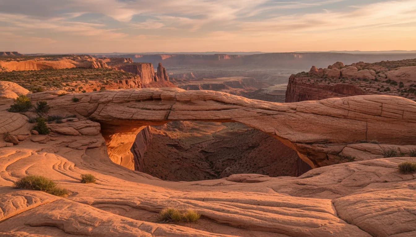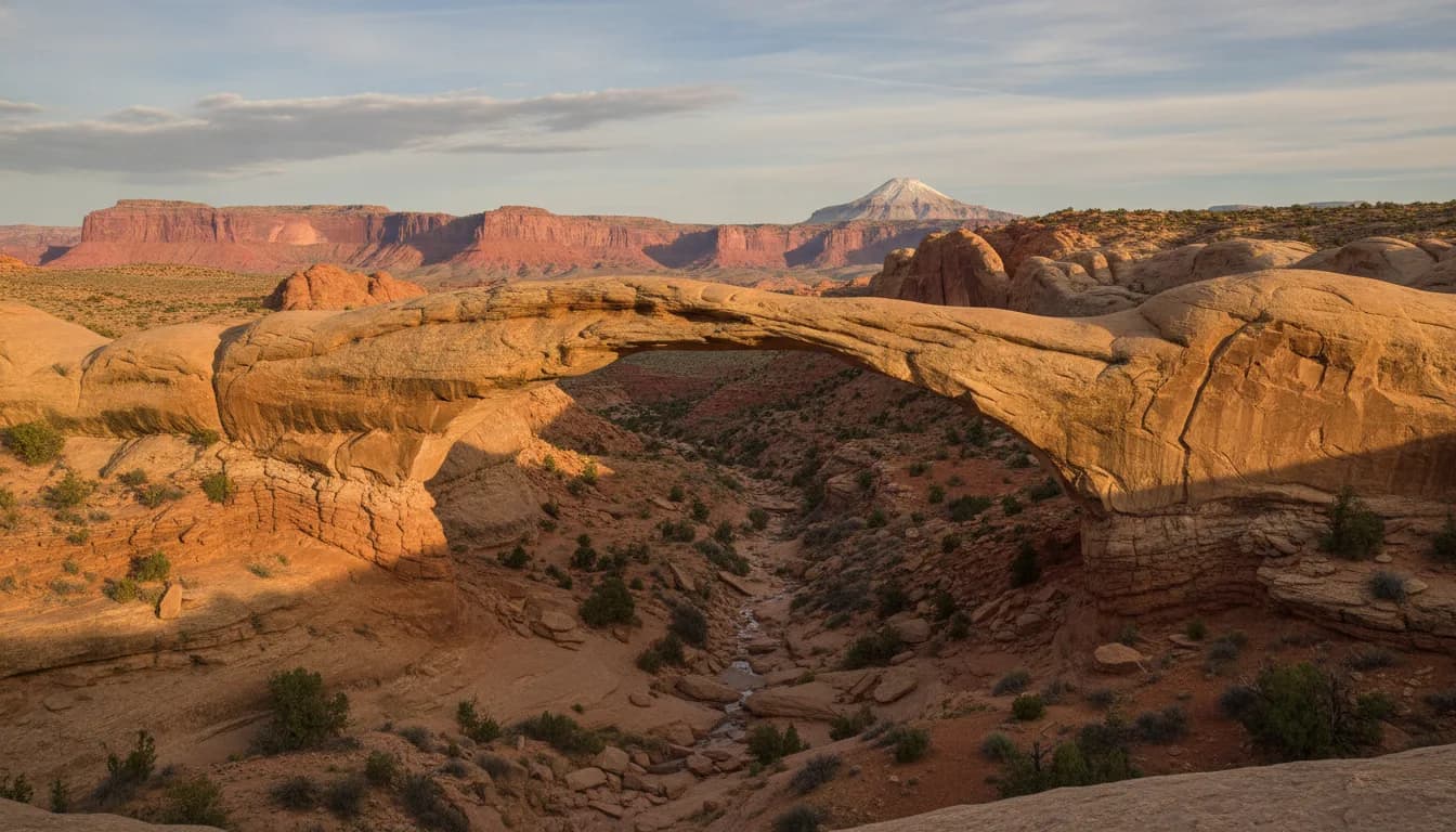
Hickman Bridge is a 133-foot natural bridge reached by a trail of about 2 miles round trip with 400 feet of climbing, rated moderate by the National Park Service. The trailhead is on Highway 24, two miles east of the visitor center, and because the park's entrance fee applies only to the Scenic Drive, hiking it costs nothing. It is one of the most popular trails in Capitol Reef, and the rare famous hike that is actually a fair size for almost everyone.
If Capitol Reef has a default first hike, this is it. We send nearly every guest here on their first morning, because it delivers the park's whole argument, canyon, dome, desert garden and a giant sandstone span, in about an hour and a half of walking.
Why It Is the First Hike
Natural bridges of this size are rare enough that whole parks are built around them, and this one sits at the end of a walk most visitors can do before lunch. The National Park Service calls Hickman Bridge one of the most popular trails in Capitol Reef, and the popularity is earned: the distance is short, the climb is honest but finite, and the destination is a 133-foot span of Kayenta sandstone that the trail loops directly beneath.
The name is local history. The bridge honors Joseph Hickman, a Wayne County school principal and later Utah legislator who, per the park's trail brochure, was an early advocate for the area and promoted it as "Wayne Wonderland" in the years before it became a national monument. He did not live to see the designation; the park's own timeline records that he drowned at Fish Lake in 1925. Capitol Reef became a national monument twelve years later, and the most-walked trail in it carries his name.
The Trail Itself
One number needs untangling before anything else. The National Park Service trail guide table lists Hickman Bridge at 0.9 miles, but that table gives one-way distances; the Park Service's own notice for the trail calls it 2 miles round trip, and the park's trail brochure says 2.2. Call it about two miles and plan accordingly. Our things to do guide explains this one-way quirk across the whole trail table.
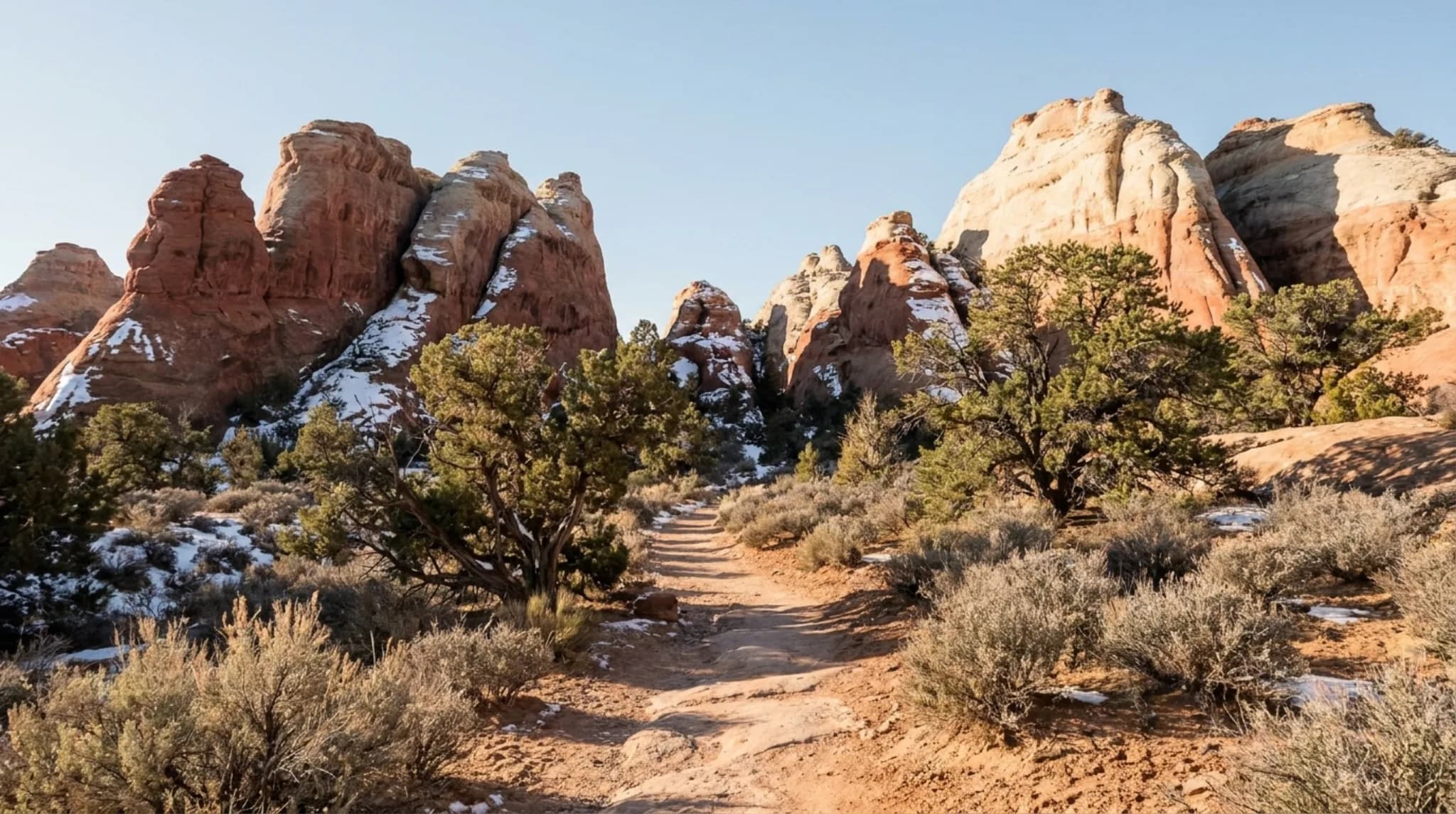
The shape of the hike: a moderately steep start climbing away from the Fremont River, described in the brochure as having high steps, then easier walking through a slickrock basin to the bridge. The Park Service rates it moderate, its category for a mix of steep grades and level sections. At the end, the trail forms a small loop that passes under the bridge and around it, so you finish by walking through the thing you came to see, then rejoin your route back.
The brochure notes there is often sand on the slickrock, which is worth taking literally: the footing asks for real shoes, not grip-free soles.
What You Walk Past
Hickman Bridge is a self-guiding nature trail, with numbered posts along the route keyed to the park's brochure. Most hikers march past the good ones, so here is what to slow down for:
A Fremont pithouse
A short side path leads to the foundation ring of a pithouse left by the Fremont people, who per the park's brochure lived in this area between about 300 and 1300 C.E.
A Fremont granary
Tucked into the layers of the Kayenta Formation above the trail. Look, do not climb to it; the brochure asks hikers to stay on the trail here.
A second, smaller bridge
A small natural bridge sits below the trail shortly before the main event, a preview most people never notice.
Capitol Dome
The Navajo sandstone dome that helped name the park is best viewed from this trailhead, per the National Park Service.
The bridge itself is water's work. The park's brochure explains that the span is hard sandstone left standing after flowing water eroded through the softer shale beneath it, then kept enlarging the opening. That is also the difference between a natural bridge and an arch: bridges are cut by streams, arches by weathering. The brochure gives the dimensions as 133 feet long and 125 feet high.
Directions, Parking and Fees
The trailhead is on Highway 24, two miles east of the visitor center, on the north side of the road along the Fremont River. From our property in Teasdale it is roughly 25 minutes: about 20 to the park entrance, then a few minutes further east on the highway.
The lot has a vault toilet and, per the National Park Service, suits passenger cars and a limited number of RVs. It is small for the trail's popularity; the Park Service notes that parking at many trailheads fills by 9 am in season and stays crowded until late afternoon.
For visitor center hours and the full fee table, see our visitor center guide.
Best Time to Go
Spring and fall are the park's ideal hiking seasons per the Park Service, with less chance of snow or dangerous monsoon rains. On this trail specifically, the calendar matters less than the clock: it is the park's busiest path, so early morning gets you parking, cool air and an empty bridge, and late afternoon is the second-best version.
Summer needs respect on two counts. The Park Service's blanket warning applies, the summer sun is intense and the trail is largely unshaded once you leave the river, and monsoon thunderstorms bring flash flood risk to washes and narrow canyons, which the brochure flags on this route as well. Morning is the summer answer. Winter works on dry days; the initial climb holds ice after storms, so ask at the visitor center.
Photography
The bridge is a wide-angle subject. It is big and you get close, so a phone does the job, and the loop under the span gives you angles most famous formations never allow.
- Morning light reaches into the basin and lights the bridge without the harsh contrast of midday; the classic frame is from the loop's east side, with sky under the span.
- Put a person under it. With 133 feet of rock and no reference, photographs flatten. A hiker beneath the span is what makes the size legible.
- Turn around on the climb. The views back over the Fremont River to Capitol Dome are the trail's second subject, and the trailhead is the park's named viewpoint for the dome.
What to Bring
Short does not mean casual here. The Park Service's park-wide rule is to always carry water, with a minimum of one gallon per person per day as its day-hiking figure; for this trail two liters each is a sensible floor in warm weather.
Water, even for two miles
There is none at the trailhead or on the trail, and the climb comes first.
Shoes with grip
High steps early, then slickrock that often carries sand, per the park's brochure.
Sun protection
Hat and sunscreen. Shade is momentary once you top the first climb.
The brochure
Pick up the self-guiding trail guide so the numbered posts mean something. It is the difference between a walk and a very good hour of local history.
The fuller checklist for this country is in our packing guide.
Continuing Higher: Rim Overlook and Navajo Knobs
The same trailhead serves the park's two big viewpoint hikes; the National Park Service lists all three routes under one shared trailhead. Partway up the Hickman trail, a signed junction sends the ambitious right:
From the same parking lot, per the NPS trail guide
- Hickman Bridge0.9 mi one way · 400 ft · Moderate
- Rim Overlook2.3 mi one way · 1,110 ft · Strenuous
- Navajo Knobs4.7 mi one way · 1,620 ft · Strenuous
Rim Overlook ends on the cliff edge directly above Fruita; Navajo Knobs continues the same line to a 360-degree panorama. Both are proper efforts. A good pattern for a fit hiker is the bridge first as a warm-up and the decision about going higher made at the junction, with plenty of water either way. If your second hike is happening on another day, Cassidy Arch, over on the Scenic Drive side, is the park's other signature destination.
Frequently Asked Questions
How long is the Hickman Bridge hike? About 2 miles round trip with 400 feet of elevation gain, rated moderate by the National Park Service. The park's trail guide table lists it at 0.9 miles, but that figure is one-way; the park's own trail-reopening notice calls it 2 miles round trip.
How big is Hickman Bridge? The National Park Service lists the span at 133 feet. The park's own trail brochure adds that it stands 125 feet high. The trail passes directly under it, which is the best way to feel the size.
Is there a fee to hike Hickman Bridge? No. The trailhead is on Highway 24, and the National Park Service charges its entrance fee only for the Scenic Drive past Fruita Campground. The park has stated that the trails along Highway 24 can be accessed without paying an entrance fee.
Who is Hickman Bridge named after? Joseph Hickman, a local school administrator and Utah legislator. The park's trail brochure says he was an early advocate for protecting this area, which he promoted as Wayne Wonderland before it became a national monument.
What else is on the Hickman Bridge trail? It is a self-guiding nature trail with numbered posts keyed to the park's brochure. Along the way are the foundation ring of a Fremont pithouse, a Fremont granary tucked into the cliff, and a second, smaller natural bridge below the trail. The Rim Overlook and Navajo Knobs trails also branch from the same route.
When should you hike Hickman Bridge? Early or late in the day. The National Park Service notes that parking at many trailheads fills by 9 am in season, and this is one of the park's most popular trails. Summer adds intense sun and monsoon flash flood risk, so mornings are the season's best window.
Distances, elevation, difficulty rating, bridge dimensions, trailside features and fee rules are as published by the National Park Service for Capitol Reef National Park and in the park's official Hickman Bridge trail brochure. Conditions change with weather; the park line is 435-425-3791. Staying near the park? Our place in Teasdale is about 20 minutes from the entrance and 25 from this trailhead.