Morgan Kotter10 min read
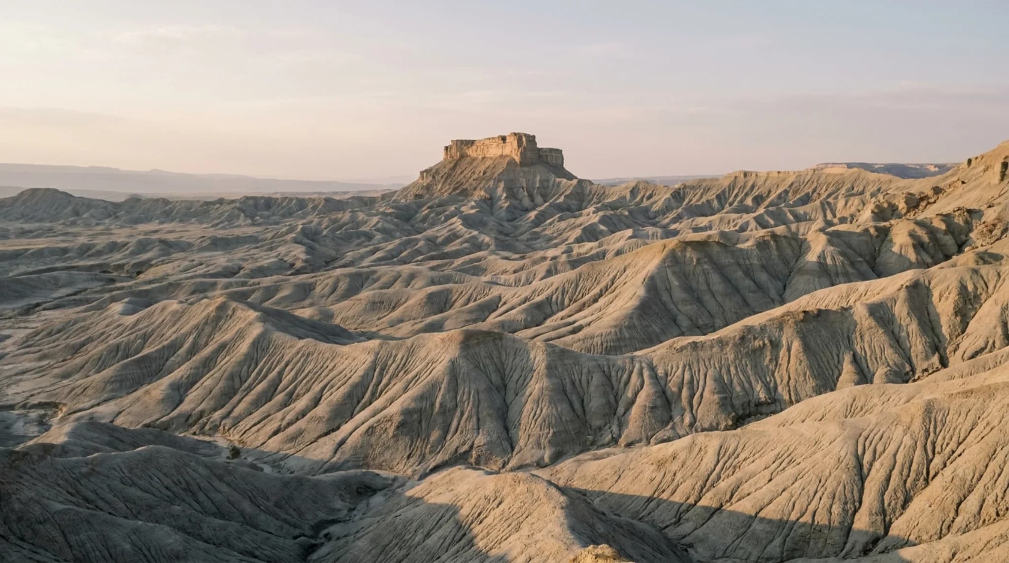
Factory Butte is a free-standing butte in the Mancos-shale badlands of south-central Utah, 12 miles west of Hanksville on State Route 24. It is visible directly from the paved highway, so seeing it requires no special vehicle. Riding there is a different matter: the BLM allows off-highway vehicles only inside three designated open areas totalling roughly 8,000 acres, and on more than 200 miles of designated routes. Everything outside those boundaries is closed to cross-country travel to protect endangered plants.
Factory Butte is one of the most photographed formations in Utah that almost nobody plans a trip around. It is usually something people notice through a windshield on the way to somewhere else, which is a shame, because the badlands it stands in are more interesting than the butte itself and reward getting out of the car.
Where Factory Butte Is
The Bureau of Land Management gives the location plainly: 12 miles west of Hanksville, Utah, on State Route 24. It stands north of the Fremont River, in the stretch of desert between the eastern boundary of Capitol Reef National Park and Hanksville.
The whole area was designated a Special Recreation Management Area in October 2008, which is the administrative act that created the open-area boundaries described below.
Getting There from Capitol Reef
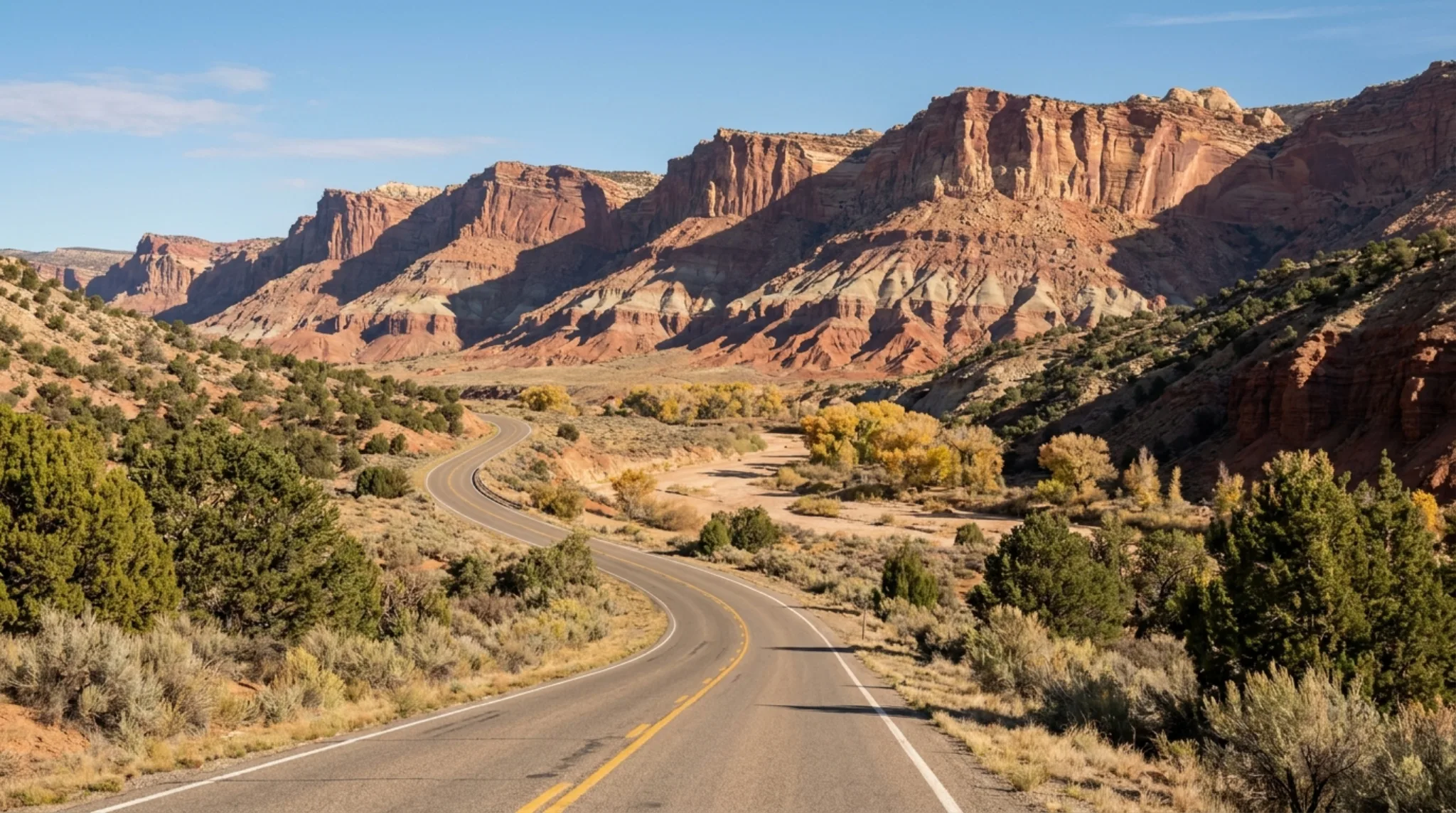
From Torrey or Teasdale you drive east on SR-24, through the national park, past the visitor center and the Fruita orchards, and out the eastern side into open country. Factory Butte comes up on the north side of the highway as you approach Caineville.
The drive itself is a large part of the value. SR-24 through the eastern park is one of the better paved miles in southern Utah, and the transition from the Waterpocket Fold into the grey Mancos badlands happens over about fifteen minutes.
What You Are Actually Looking At
The formation sits in Mancos shale — a soft, fine-grained marine sedimentary rock laid down when this was the floor of the Western Interior Seaway. Shale erodes fast and erodes evenly, which is why the surrounding badlands are so densely and regularly ridged. The butte survives because a harder cap rock on top has protected the column beneath it while everything around eroded away.
The practical consequence of shale is the one that catches visitors out: when it gets wet it turns to a slick, deep, clinging mud. This is not a surface that dries quickly or that traction control saves you from. Rain anywhere in the area changes what is drivable, sometimes for days.
The OHV Areas — What Is Open
This is the part people get wrong, and the part with real legal consequences. Riding is permitted, but only in defined places.
The BLM manages three OHV open areas where cross-country motorized travel is allowed:
Swing Arm City
2,602 acres. The largest and best known of the three, between Factory Butte and Caineville on the north side of the highway. This is the purpose-built play area, and the one most riders mean when they talk about riding here.
Factory Butte
The open area immediately around the butte itself. In 2019 the BLM reopened 5,400 acres to OHV recreation here after roughly ten years of monitoring following an earlier closure.
Caineville Cove
The third designated open area, east toward Caineville. Smallest of the three.
Together these total roughly 8,000 acres of cross-country open riding, supplemented by more than 200 miles of designated routes through the wider management area. That is a genuinely large amount of legal terrain — the restriction is not that riding is scarce, it is that the boundaries are specific.
The Closures, and Why They Exist
Outside the three open areas, cross-country travel is prohibited and riders must stay on designated routes.
The reason is botanical. Endangered plant species grow in these badlands, and Mancos shale habitat is exactly where they grow. A single pass by a vehicle across untracked shale can destroy plants that took decades to establish, and the tracks themselves persist for years in a surface with no vegetation to recover.
This history is why the area is contentious. The 2019 reopening of 5,400 acres followed about a decade of monitoring, and it was welcomed by riders and challenged by conservation groups. Both positions are still live. The practical takeaway for a visitor is simply that the boundaries are real, actively managed and worth checking against a current map rather than a blog post — including this one.
Photography
Factory Butte is a light-dependent subject more than a composition-dependent one. The badlands in front of it are a field of near-identical ridges, and they only read as texture when the sun is low enough to put a shadow in every fold. At midday the whole scene flattens into grey.
Early and late
Low, raking light is the entire trick. The ridge texture that makes the photograph appears and disappears within about an hour of sunrise and sunset.
Both ends of the day work
The butte is visible from a long stretch of highway, so you can position for front light or back light depending on which side you shoot from.
After a storm
Wet shale darkens dramatically and the contrast against a clearing sky is the best this place looks — provided you stay on pavement to get it.
Scale needs a subject
The badlands have no trees and no buildings, so nothing conveys size. A vehicle or a person in frame is usually what makes the photograph legible.
Facilities and Safety
The BLM lists a restroom and interpretive kiosks at Factory Butte. It does not publish drinking water, developed camping or fee information for the site, and you should plan on the assumption that none of those exist.
No water
Carry everything you will drink, plus a margin. Summer here is genuinely dangerous and there is no shade of any kind.
No cell signal
Assume none. Tell someone your plan before you go, and download maps in Torrey or Hanksville.
No fuel
Nearest is Hanksville, 12 miles east, or Torrey about an hour west.
Flash flood risk
Badlands drain fast and hard. Do not be in a wash when rain is falling anywhere upstream, which may be somewhere you cannot see.
After Dark
The badlands east of Capitol Reef are among the darker places you can stand in the lower 48, and Factory Butte is a recognisable silhouette against a star field. It is a legitimate night-photography subject and a reasonable place to simply stop the car on the way back from Hanksville.
Two practical notes. The drive back to Torrey is about an hour in full darkness with wildlife on the road, so build that into the plan rather than discovering it. And the same lack of light that makes the sky good makes the ground hazardous — the shale is cut with drop-offs that are invisible at night.
For a place to actually spend the night under that sky rather than drive home from it, Torrey holds an International Dark Sky Community certification and Capitol Reef is a certified International Dark Sky Park.
Frequently Asked Questions
Where is Factory Butte? The Bureau of Land Management places Factory Butte 12 miles west of Hanksville, Utah, on State Route 24. It sits north of the Fremont River in the badlands between Capitol Reef National Park and Hanksville.
How far is Factory Butte from Capitol Reef? It is east of the park along SR-24, roughly an hour's drive from the Capitol Reef visitor center and from Torrey. It works as a half-day trip, not a stop you take in passing.
Do you need a 4WD to see Factory Butte? No. The butte is visible from State Route 24, which is paved, and there is a restroom and interpretive kiosk at the site. Driving beyond the maintained access onto the shale requires appropriate vehicle and conditions, and the shale becomes impassable when wet.
Can you ride OHVs at Factory Butte? Yes, but only inside the designated open areas and on designated routes. The BLM manages three OHV open areas here — Swing Arm City, Factory Butte and Caineville Cove — totalling roughly 8,000 acres, alongside more than 200 miles of designated routes.
How big is Swing Arm City? Swing Arm City covers 2,602 acres. It sits between Factory Butte and Caineville, on the north side of the highway.
Why are parts of Factory Butte closed to cross-country travel? Endangered plant species grow in the surrounding badlands. The BLM requires riders to stay within the open play areas and on designated routes for that reason, and notes that violating the Endangered Species Act carries a maximum fine of $50,000 and up to a year in prison.
Is there camping or water at Factory Butte? The BLM lists a restroom and interpretive kiosks at Factory Butte. It does not publish drinking water, developed camping or fee information for the site. Bring all your own water — this is open desert with no services.
When is the best time to photograph Factory Butte? Early and late, when low sun rakes across the ridges of the badlands and creates the texture the formation is known for. Midday flattens it. The butte faces the highway, so both sunrise and sunset are workable depending on where you stand.
Location, acreage, facility and enforcement details are as published by the Bureau of Land Management for the Factory Butte Recreation Area. Boundaries and open-area designations have changed within the last decade — confirm current maps with the Henry Mountains Field Station at 435-542-3461 before riding.